Placitas Mapping Project
This is the first UAS mapping project I ever completed. The orthomosaic and model were created in Agisoft
Metashape.
The final maps were created in ArcMap. This project was completed for the UNM course EPS 400- Drones.
The idea behind this project was to create an orthomosaic and 3D model. In turn, I added the task of using ArcMap machine learning to locate juniper trees within the study area.
All end products seen were created using UAS imagery collected from a DJI phantom 4.
Study Area Map
This map shows the juniper trees and shadows that were classified using ArcMap.
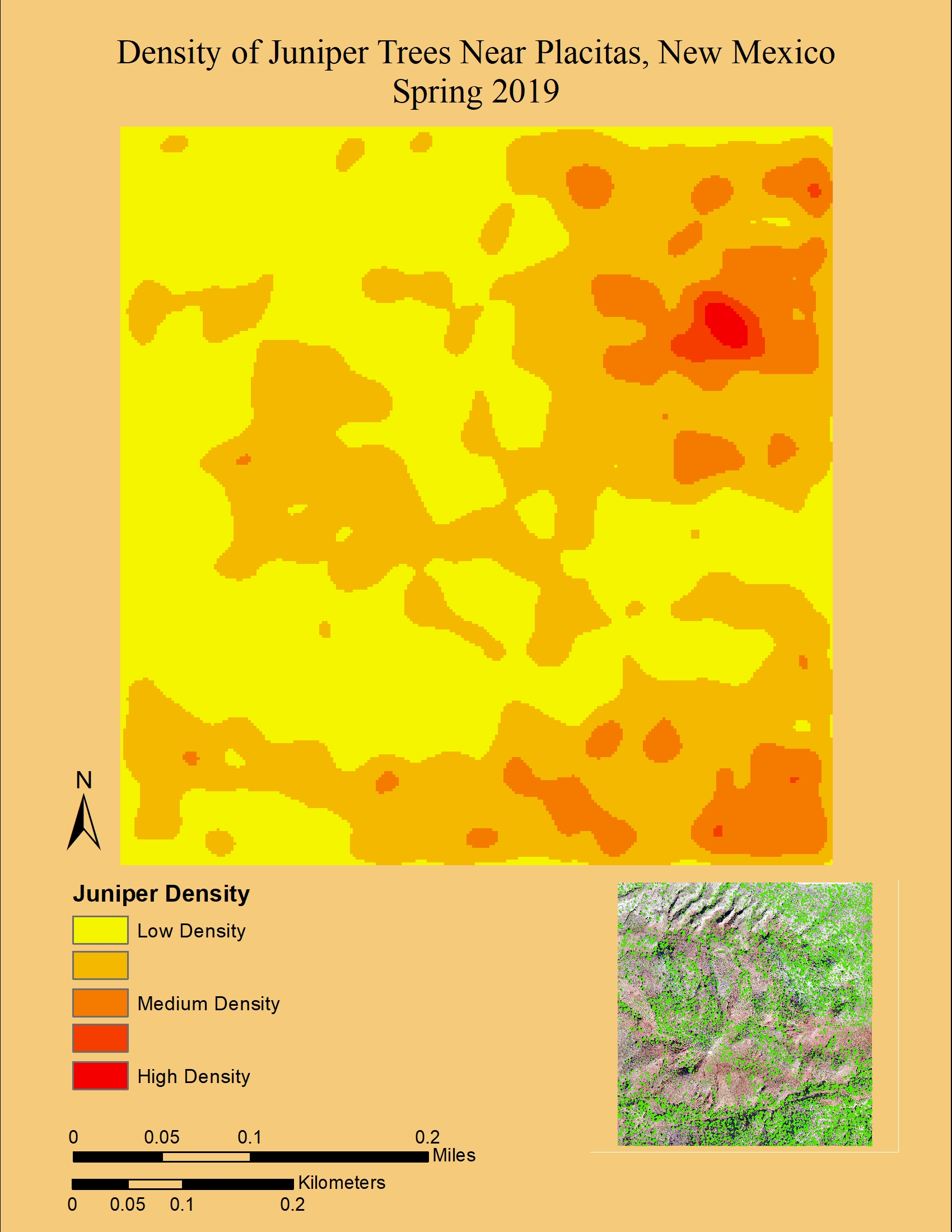
Juniper Tree Heatmap
This heatmap displays the density of juniper trees within the study area.
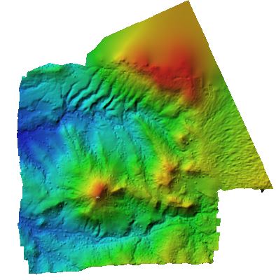
DEM of the study area.
This DEM was created via Agisoft Metashape.
Video displaying the generated 3D model.
This video displays the model from a vertical "fly over" perspective.
Video displaying the generated 3D model.
This video displays the model from a horizontal "around" perspective.